11.6.5.1
If a property is in the SNN Authority administrative area but the relevant Street exists in a neighbouring SNN Authority a new Street in the ASG must not be created. Instead the appropriate USRN with both the type 11 Interest and 15 Street Description Records (see DEC-NSG) must be obtained from the neighbouring SNN Authority / Local Highway Authority, Authority Street Custodian and entered into the SNN Authority LLPG. See Figure 11.
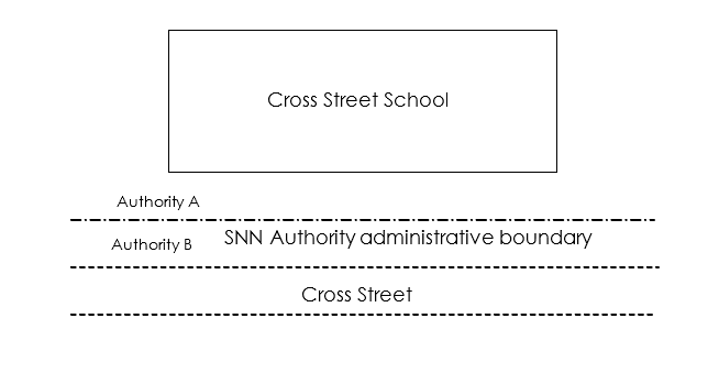
Figure 11 - Street in neighbouring SNN Authority
- In Figure 11, a property is on the boundary of an SNN Authority administrative area and must be associated with a Street in the adjacent SNN Authority because that Street provides the primary access. Details of the Street, when added to the LLPG of the SNN Authority (Authority A), must be flagged for exclusion from transfer to GeoPlace. This is because the SNN Authority is not allowed to modify the details associated with any Street which is allocated a USRN within the range for an adjacent SNN Authority. However, the BLPU created with its LPI associated with the excluded Street must be transferred to GeoPlace. This must include the BLPU Record, the LPI Record and any associated cross reference Records.
11.6.5.2
If the administrative boundary runs down the centre line of a Street resulting in one half of the Street being in one Local Highway Authority (a County Council or Unitary Council) and the other side in the adjacent Local Highway Authority (a County Council or Unitary Council), two USRNs shall exist within the NSG. Each SNN Authority either a District Council or a Unitary Council shall create the appropriate USRN for their respective SNN Authority administrative area. See Figure 12.
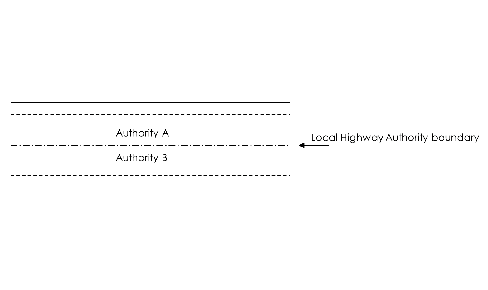
Figure 12 - Local Highway Authority administrative boundary in centre line of Street
- In Figure 12, both SNN Authorities must enter a Record for the Street. It is the responsibility of each Authority Address Custodian to identify which SNN Authority (a District Council or Unitary Council) and Local Highway Authority (a County Council or Unitary Council) has an interest in which part of the Street.
11.6.5.3
If a District Council boundary runs parallel to or down the centre of a Street and the adjoining District Council is within the same Local Highway Authority (a County Council), only one USRN for that Street shall exist within the ASG and NSG. The District Councils must agree between themselves which USRN is used.
11.6.5.4
The start and end points must be the same in both the NSG and the ASGs, providing that the Local Highway Authority administrative boundary continues along the Street centre line.
11.6.5.5
If the SNN Authority administrative boundary dissects a Street resulting in one Street being in two SNN Authorities, two USRNs shall exist with each SNN Authority creating the appropriate Street Record for their respective SNN Authority administrative area. The locality Field or town name Field shall be used if both sections are the responsibility of the same Local Highway Authority to ensure each USRN has a unique textual identifier. The start and end points must be agreed between the Authority Street Custodian and both the Authority Address Custodians. See Figure 13.
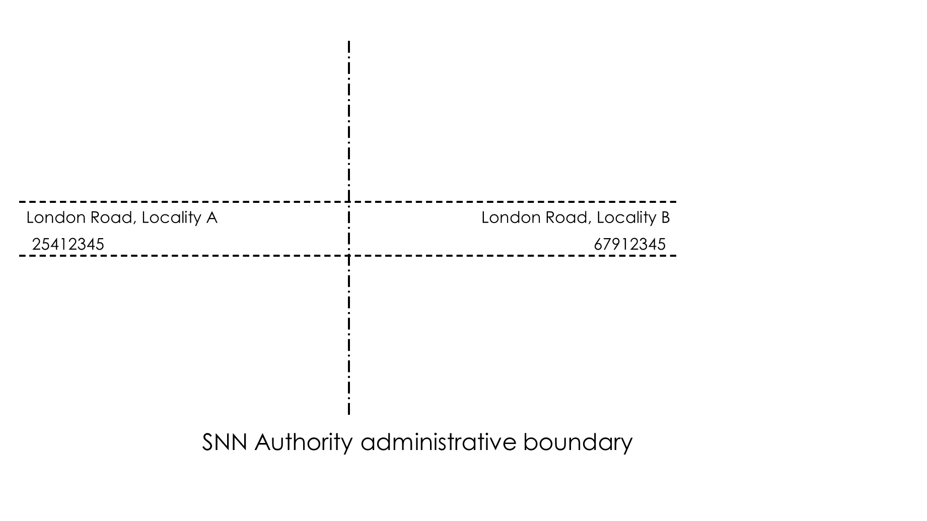
Figure 13 - SNN Authority administrative boundary dissects Street